Weather seemed to favor us leaving so lines released we motored out and into the channel to leave Cape May. Tom was at the helm so I took Photos of what I saw going in. We encountered the tide going out and waves more than three feet hitting right on the nose. For a while we were only going 1kt and taking a lot of water on deck. We finally had the tide turn and passed the Brandywine shoal light and scooted down the bay at 6kts plus. We decided to stop at Delaware City Marina for the night and with the help of their dock master were safely tide to the dock and had a wonderful dinner at Crabby Dick's
 |
| Thee Sons our 120' neighbor |
 |
| The Lobster House |
 |
| Fishing Fleet for Lobster House |


 |
| marsh land birds |
 |
| Nautical Dreamer |
 |
| Coast Guard Boat |
 |
The present Cape May Lighthouse, located at Cape May Point,
NJ, is the third beacon to aid navigation where the Atlantic Ocean and the
Delaware Bay meet. The first structure, built in 1823, was destroyed by
erosion. The site now lies approximately 100 yards off shore southwest of
the present tower. Due to poor maintenance and construction, the second
beacon, built in 1847, had to be demolished in 1862. The base was
retained and used for storage. The third and present tower was built in
1859 and is constructed of double brick masonry walls. The tower stands 157
feet and six inches tall - with a cast iron spiral staircase of 199 steps
leading up to the lantern room. Originally maintained by Keepers employed
by the US Lighthouse Service (USLHS), the beacon is now administered by the
Mid-Atlantic Center for the Arts (MAC) which was overseen the complete
restoration since 1986.
|

 |
there are shoals
Delaware Bay: New England / Mid-Atlantic Coast
Area: 16,631 Acres
Habitat: Shallow open waters and associated shoals at the mouth of the Delaware Bay
Site Description: This site includes the shallow waters at the mouth of the Delaware Bay located between the southwestern tip of Cape May Point, NJ and Delaware. The IBA encompasses Prissywick Shoal, Eph Shoal, Middle Shoal, Overfalls Shoal, Somers Shoal and the unnamed rips closer to Cape May Point. These waters and shoals provide extremely valuable foraging and staging habitat for water birds year-round. |
 |
| Waves build in what looks like open ocean |
 |
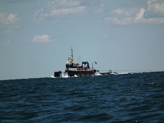
| Tug and tow |

 |
| Tom before we entered the bay and rough ride |
 |
Fourteen Foot Bank Lighthouse is located in the lower part
of the Delaware Bay on the western side of the shipping channel. The
"Victorian" structure, originally brown in color, was the first US
Lighthouse to be built on a submarine foundation with the caisson sunk by a
pneumatic process -- 20 feet down into the shoal. Its 4th order Fresnel
lens was first lit on December 1, 1886, which allowed the Fourteen Foot Bank
Lightship to be taken off station. Somtime during the 1930's, the entire
cast-iron structure, including the "hip roof" privy located at the
railing on the northwest side, was repainted white with black trim and remains
the same today. Although automated and without keepers since 1972, its
beacon still provides safe passage to all ships traveling the Delaware Bay.
|
 |
Brandywine Shoal Lighthouse is located at the southernmost
part of the Delaware Bay, northwest of Cape May Point. It was the first
screwpile lighthouse ever built in the United States. Its 3rd order
Fresnel lens shone for the first time on October 28, 1850. After serving
well for over 60 years, a new conical structure, requiring less maintenance,
was built on a caisson of reinforced concrete and was lit on October 20,
1914. This Light Station is still an important aid to navigation and was
the last Lighthouse in the Delaware Bay to have a keeper on board!
Automation took place about 1974...the end of a once proud era!
|


No comments:
Post a Comment